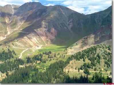
For your serious mineral prospector. I've not been underground on this property, but according to the maps it looks like there are several thousand feet of tunnel. Ground Floor Opportunity. Excellent investment properties located in Minnehaha Basin, just East of Gladstone. The properties are as follows: first is the claim name followed by the US mineral survey number followed by the number of acres in that claim: Minnehaha 14425 10.331 acres Rouena 16393 9.501 acres Rouena #1 16393 10.331 acres Would look at exchanging for income property. The county road runs through these parcels. They are contiguous to each other. Views beyond belief. See the backside of Red Mountain Pass. See the backside of the mountains around Telluride. One person, who had just returned from Glacier National Park, told me that these views rivaled those he had just seen. Your buyer will get title insurance and a general warranty deed. The Minnehaha Mine nearly adjoins the old Lead Carbonate mine which appears to have vein structure running southeasterly right onto these properties. It is at the very westerly end of the old Sunnyside mine which had been operating for nearly 100 years. There is fairly extensive tunneling on the Minnehaha and in the associated docs I have a very thorough assay map of level number 2 on the Minnehaha mine. This map shows the assay results for gold, silver, lead, zinc, and copper. I recently had some assay work done searching for the element tellurium and it did come back positive for that element. Tellurium is used in the construction of solar collectors and the now famous Gold King mine, which lies about a mile north west of these claims, contains one of the largest tellurium deposits in the country. That represents multiple thousands of dollars of work. As can be seen by the pictures, numerous mineralized outcrops are on this property. The entrance to the tunnel has been cribbed although overburden has come down over the opening. No water is coming out of the mine. Sellers will retain a small royalty (If your buyer ever mines, the sellers get a royalty. But the sellers are not allowed to mine and the sellers cannot make your buyer mine.)
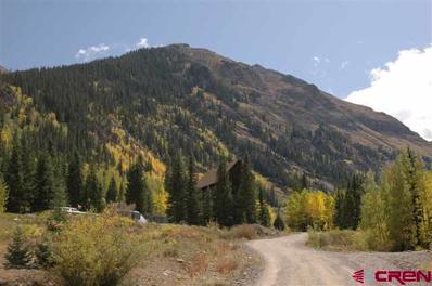
The property would lend itself well to being developed into a destination retreat lodge and cabins. The large, substantial post and beam structure is in excellent condition except for the fact that a lot of cosmetic finish work would be required in order to make the building habitable and functional as a lodge. The structure was built to last and withstand the dynamics of supporting the cables and heavy weight load of ore being transported down from the mountain top mine. The old Stoney Pass Road which was utilized as the main roadway from Del Norte over the Continental Divide to Silverton runs through the property. This location is now a gateway to high mountain recreation and would provide for an excellent "base camp".

Silverton is located in Colorado. Silverton, Colorado has a population of 638. Silverton is more family-centric than the surrounding county with 23.6% of the households containing married families with children. The county average for households married with children is 21.59%.
The median household income in Silverton, Colorado is $64,167. The median household income for the surrounding county is $63,333 compared to the national median of $69,021. The median age of people living in Silverton is 44.1 years.
The average high temperature in July is 74.1 degrees, with an average low temperature in January of -3 degrees. The average rainfall is approximately 24.2 inches per year, with 163.2 inches of snow per year.